Traveling through Canada in this episode, the boys have a great time.


The Trent Waterways are sometimes spoken of as The Trent Canal, and the Trent Valley Canal. The Canadians prefer Trent waterways, and I agree with them, because that name is the most descriptive. The route is 250 miles in length, but only 32 miles of it is excavated canal prism. It is in reality a waterway for small craft plying between Georgian Bay and Lake Ontario directly across the Province of Ontario, and is a chain of lakes and rivers, improved for navigation and hydro-electric development. The part of it which could be called Canal is the scanty mileage where it was necessary to dig ditches to connect the various lakes and rivers. The route embraces a magnificent variety of water levels over which shipping is carried through a total of 46 locks. Of these locks, two are hydraulic lift locks, two are marine railways, and the remainder - ordinary float locks.
So much descriptive matter has been written and published concerning the Trent Waterways that it seems unnecessary to go into a lengthy description of them here. I will say, however, that the waterway is a monumental piece of work, and one from which other countries may gain valuable knowledge. Considering the population of Canada, and the amount of money that the Dominion Government had available for carrying out the project, it is all the more commendable. Prior to our arrival in the Trent Waterways we had been through a few locks and canals in the United States, and one would have to be blind to refrain from drawing comparisons. Without exception the construction work of our own waterways in the states had been cheap, slipshod and temporary - locks made of wood, or of concrete containing so much sand and so little cement that there was nothing permanent about them.
In the Trent Waterways, in bold contrast to such works as seen in our own country, we found locks and other construction work built of solid masonry or honest concrete which will still be in service when the great-grandchildren of the men who did the work will have gone to the dust from which the Maker created them. A cruise through the Trent Waterways is an eye-opener to any bigoted American who carries the delusion that only in his own country is anything worth while ever done.
 |
| CLICK MAP TO VIEW LARGER IMAGE |
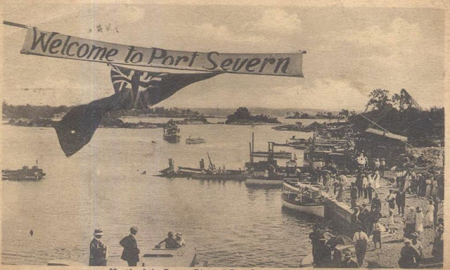
On September first, the day that Transcontinental cruised up the Severn River, which forms the last few miles of the extreme western end of the Trent Waterways, the wind blew a howling gale. The weather was fair, but the atmosphere was thick with smoke from nearby forest fires fanned to fury by high winds. Most parts of the Severn River are so narrow that a rock could be hurled ashore almost anywhere. But, there are a few wide places where the impounding of the river for hydro-electric development and the improvement of navigation has spread the water through surrounding lowlands. One of the first of these places we encountered was Gloucester Pool, quite a sizable lake, where the wind was sweeping down the length of it to kick up one of those nasty, choppy, little seas, for which these small inland bodies of fresh water are infamous. We got soaked to the skin with flying spray before we ran the length of Gloucester Pool, and were glad when we reached the warm sunshine and modified breeze of the narrow reaches of the river again. The current in this portion of the Severn River is very moderate - probably not more than one mile per hour on the average

But, there are a few places where the river flows between narrow, rocky walls that the current becomes quite noticeable. One of the most vigorous of these places is encountered just below the first marine railway at Big Chute, 8 miles above Port Severn. Studying the chart for this section, I was somewhat perturbed by the narrowing down of the channel at that point, and a notation on the chart reading: "swift current - proceed cautiously, and steer close to log boom on the right bank."
Arriving at the narrows, however, I discovered I'd been crossing a bridge that really didn't exist. The dreaded rapid was only a riffle of gently sloping water, up which the Transcontinental walked as if she'd merely encountered a little heavy going. With a shock-breaking boom of logs strung down both banks to keep boats off the rocks, losing steering way, or even a motor failure didn't appear to be thing much to be dreaded. After we were up the riffle, I looked at the chart again and chuckled to myself of the careful forethought and caution of the Canadians. We'd come through hundreds of rapids that were a hundred times more dangerous than this one - , and, nobody had taken the trouble to chart a warning of danger, or string log booms to protect the paint and planking of our battered little cruiser.
Our cruise through the Trent Waterways will always be remembered as one of the most pleasant portions of the entire ocean-to-ocean run across North America. There were several reasons for this. Quiet water for small boat cruising, and close-up scenery were the greatest factors toward making the route enjoyable for us. Next to that the wonderful courtesy, politeness, and hospitality of the Canadians; and the excellent management of the canal system contributed substantially to our pleasure of cruising in those waters. The importance of close-up scenery in easily navigable waters was more forcibly impressed upon me in the Trent Waterways than elsewhere on the 5280 mile cruise.
Motor boatmen contemplating a cruise would do well to consider this subject because it is to boating pleasures precisely what good scenery and good roads are to land motoring. We had cruised through some of the most magnificent country in all of America when we came up the Columbia River from the Pacific Ocean, but in that tremendous river all scenic enjoyment had to be derived at long range. Even then the difficulties of navigation were such that we were usually compelled to give far more attention to navigating than to scenery and other pleasures of the journey. In the Missouri River we had cruised for 2284 miles through a tremendous variety of scenery, but most of the time and attention had been occupied by the necessity of keeping eyes glued to upon the river - avoiding snags, sand bars, falling cut banks, trying to follow the current and remain afloat. In the Great Lakes our vistas from day to day had been largely sky and water, or dodging huge rooster tales of water that threatened to pound Transcontinental into Davy Jones's locker.
In the Trent waterways, however, everything was different. We found ourselves cruising though quiet inland waters, usually within a stone's throw of the shores - shores that were either rugged wilderness of beautiful parks in the vicinity of populated areas. The problems of navigation were so simplified by our large scale charts, and buoyed channels, that keeping our correct course became one of our least considerations. There was so little of anything to do but cruise and enjoy ourselves. The numerous locks automatically took care of any attempt on our part to make mileage that might be fatiguing.
Additional pleasure was ours in the Trent Waterways by reason of the receptions we got everywhere, and the interest of every person along the route in our attempt to get across the continent by boat. During the several weeks that we cruised in Canada the people made us feel almost as if we were guests of the Dominion. I met only one blubberhead who ventured the conventional British jeer at Americans -"Who won the war?"
 |
This is a small portion of a large illustrated folding stationary sheet. CLICK HERE to view all.
Double click on images there to get them enlarged so you can see the amazing detail. |
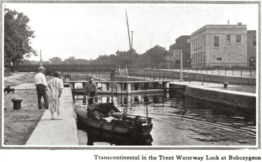
Before I could reply to suggest that he ask the Kaiser, the keeper of the lock where we had stopped, swung his boot in the direction of the fellow's rear, and grabbed him by the nape of the neck. The lockkeeper was a powerful chap, and held his victim as if he had been a rabbit. "I've a mind to throw you in the canal, Sir," he exclaimed. "But I shall not do that. You're a disgrace to your King, and I'll eject you from the King's property." With that he led the man to the gate that enclosed the top of the lock structure, pushed him through, and closed the gate. Returning to me the lockkeeper apologized for the fellow's conduct, and said: "Pay no attention to such blighters. We've a few of them - more's the pity."
Meanwhile I could scarcely restrain myself from laughter at the lockkeeper's polite language while disposing of the annoyer. A bit of profanity would have been justifyed, but this British-Canadian indulged in none of it. A little later he said to me: "I observe from your American Legion pin that you've been a soldier too. You did your part, and that's all any of us can do. I was in the trenches for four years myself, and we were all jolly glad when the Yanks got there."
 |
| World War I volunteers, Fergus Fall, Minnesota |
The trip over the marine railway at Big Chute gave us an opportunity to inspect the hull of the Transcontinental, the first since we'd had the boat out of water at Milwaukee. We were delighted that scarcely a flake of paint had been knocked off. The inspection revealed, however, that we had lost two screws that held the half round brass shoe to the bottom of our keel. While I was replacing these the railway operator told me that yachtsmen very frequently took advantage of the dry docking facilities offered by the two marine railways for making under water repairs to their boats.
After making the remainder of the run up the Severn River, through Sparrow Lake, and up the 42-ft. lock below Washago, we reached the level of Lake Couchiching, which is also on the same level as Lake Simcoe.
Couchiching is an Indian word meaning "many winds", and we found Lake Couchiching to be just that. The gale that had swept the country all morning seemed to be coming from every direction and in violent puffs when we passed out of the Washago Canal into the lake.
Consequently the lake was terrifically rough, and we were badly handled before we finished the ten mile run through this wide stretch of open water into Orillia. There were several hours of daylight left when we docked at Orillia, but with Lake Simcoe just ahead, we knew we could not attempt to use them. Lake Simcoe is nearly 30 miles long and 15 miles wide. The view into it from the residential section of Orillia is much the same as looking out on Lake Michigan from Chicago.
 |
| This was too cool not to use...1940ish. |
Our route was directly across it to the mouth of the Gambridge Canal just nort of Beaverton, and for us there was no crossing Lake Simcoe that day. Orillia, however, was a good place to end the day's cruising. It is a beautiful little city of about 10,000 population, and one of the best towns on the Trent Waterways in that part of Ontario. My desire to stop there was also augmented by a letter I carried in my portfolio, which had been handed to me by the Chief of Police of Astoria, Oregon, as we were shoving off up the Columbia on May twentieth. The letter was from the Mayor of Orillia, who hearing of our trip, mailed in care of the Chief of Police of Astoria, extending us an invitation to accept the hospitality of the city upon our arrival in that part of Ontario.
Landing at the local boat club at the head of Lake Couchiching, we soon discovered that the Mayor had been notified by telephone almost as soon as our boat was identified. Every club, dock, and marine service station had been posted to watch for us, and the watch had been maintained for weeks.
In a very few minutes the Mayor and a delegation of Orillia's leading citizens were on hand with several automobiles, and we were off to see the town. If there is anything in Orillia we didn't see, it must have been built since September second.
One of the things there that interested me more than anything else is the magnificent shaft in the public park that the citizens have erected to the memory of Champlain and the hardy pioneers who paved the way for Canada today. It seemed significant to me that the Canadians have time, thought and money for such things, while American explorers such as Lewis and Clark have received scant eulogy other than a few towns and counties to perpetuate their names.

 Orillia is the site of the Ontario Provincial Home for the Feeble Minded Persons, as it is politely termed; and the Mayor and citizens insisted upon showing us this institution.
While the institution is undeniably a model of its kind, a trip through it is somewhat depressing.
Wilton, whose religious tendencies are to see only the good and pleasant things of human life, seemed deeply impressed, as well as depressed, by the sights of the place. In summarizing his ideas to me while sitting around the hotel that evening he said: "Johnny, half the world are nuts, and the rest are squirrels. The question is - just how much of a nut, or a squirrel does one have to be to be eligible for residence in that place up on the hill - and, who is to judge?"
Getting under way the next morning we found the sky heavily overcast, rain threatening, but scarcely a breath of wind blowing. We could not have picked a more ideal morning for getting across Lake Simcoe. Rounding the bend in the narrow strait that connects Lake Simcoe and Lake Couchiching, we found the huge lake, often called the Tiger of the Trent, as placid and glassy as a plate of soup. The visibility was so low that land appeared only on the north and west shores of the lake. We took our course from the charts, checked it with our compass, and shoved off into the expanse of sky and water. After cruising for an hour. the land had disappeared on all horizons except for a couple small peninsulas that were faintly visible jutting out from the north shore. Another hour of cruising we had picked up Thorah Island near the east shore, and a dim outline of housetops and smokestacks in the town of Beaverton, which is built up onto high ground on the mainland beyond. About abeam of Thorah Island we located the first buoy marking the route to the Gamebridge Canal, and followed the buoys on in.
 |
| CLICK HERE for a close up map of the entrance to the canal. |
About the time we got into the canal the wind began to blow, and rain coming down with it. We soon realized we'd been lucky to get across Lake Simcoe, for an hour after we got into the canal above Gamebridge the crossing could not have been attempted. Moreover, had the storm caught us in the middle of the lake, we'd undoubtably have been compelled to run for the shelter of the nearest cove. Before reaching Lake Simcoe I had talked with a number of motor boatmen who were neither crepe hangers nor alarmists, and all of them warned us against taking any chances with Simcoe in heavy weather. After getting into the canalized portion of the waterway beyond Lake Simcoe, we didn't care much what the weather did. We were so used to rain and to being wet that rain was a matter of small concern. In the sheltered waters the worst the wind could do was to retard our speed a little, or boost us along depending upon which way the wind happened to blow and meanderings of the waterways.

The objective of cruising that day was Fenelon Falls, and the residence of J. W. Shelly on Sturgeon Point in Sturgeon Lake, about six miles beyond Fenelon Falls. This was a run of approximately 50 miles from Orillia, and with the umber of locks and bad weather, was a husky days mileage. Prior to our actual arrival at Fenelon Falls, I had talked to Mr. Shelly by telephone, and been with him in person for about five minutes. It was the day after the story broke in the Los Angeles newspapers announcing our intention to attempt the cruise, that Mr. Shelly phoned me. He told me he desired to get acquainted, because for a number of years he had made the practice of spending his winters in California and his summers at his home on Sturgeon Point in Ontario. Later he called at my office in Los Angeles, and extended an invitation to visit him at his summer home, because, as he stated it -"You've got to come right past my door." He marked the position of his Sturgeon Point home on our charts of the Trent waterways and gave me photographs for identification of the house and his boat landing.
I had, of course, kept in touch with him on the cruise from Oregon to Ontario, so I was not greatly surprised when we arrived at the Kirkfield Lift Lock, and the lockkeeper asked me to call a certain phone number at Fenelon Falls. After putting in the phone call it was only a minute or two before I had Mr. Shelly on the wire. He said he'd be waiting for us at Fenelon Falls, and that our hot baths and the chicken dinner would be ready at his house when we got there. The destination was still 26 miles away through the downpour of rain, but an objective well worth driving for.

As an example of the kindness and hospitality we encountered in Canada, Mr. Tough, the keeper of the Kirkfield Lift Lock, called his wife out to have a look at our boat as he recognized the outfit. "Mary, have you ever heard of this boat?" he asked, as his wife peered down at our tiny craft tied up in the lowered lock chamber. "For sure, I have," she replied in a delightful Canadian accent. "These are the gentlemen who have come all the way from the Pacific Ocean." The usual barrage of questions followed. Finally Mrs. Tough ventured to ask if we'd had any lunch. It was one-thirty in the afternoon and we'd had no lunch due to the fact there had been no place to get any, and we'd come off from Orillia in too much of a hurry to have one prepared. When the lockkeeper's wife gained this information, nothing would satisfy her but that we should come right into the house - and she'd, "Get us a bite to eat while Transcontinental was being put over the lift lick." The "bite to eat" as she called it, turned out to be a splendid home-cook meal, the first of the sort we had enjoyed in some days. And yet, I've heard Americans say that Canadians are cold and inhospitable. Wilton and I found them to be everything but that.
On the rest of the afternoon, on through the rain, up onto the level of Balsam Lake, we cruised on the highest water level of the Trent waterways - 845.5 feet above sea level, 267.5 feet above Lake Huron, and 602 feet above Lake Ontario. At Rosedale, in the water connection between Balsam and Cameron Lakes we began going down - down the veritable stairway of locks between Balsam Lake and the Bay of Quinte on Lake Ontario. Coming across Cameron Lake in a mist of rain and with the last fading rays of daylight, my glasses picked out a figure waving like a human semaphore from the first bridge above the Fenelon Falls locks. A little later I recognized the figure as J. W. Shelly.
But, he wasn't the only one. The shores, bridges, and locks were thronged with people, the combined spectators of Fenelon Falls, Lindsay and Bobcaygeon, having gathered there to greet us. Our hands were actually beginning to ache from the hearty handshakes when the lowering water in the first lock brought us relief by taking us down beyond the reach of the longest arms.


Mr. Shelly's boat, a 38-ft. mass of polished mahogany and brass, was tied up in charge of his boatman below the Fenelon Falls Locks. We immediately cruised on with Transcontinental because we knew Mr. Shelly wouldn't be long overtaking us. Presently his speedy packet shot alongside of us, and attempted to throttle down to our speed. But, it couldn't be done. "Throw us a line, boys," our host called out. "We'll put a little more speed on you. We mustn't let those chickens get cold." A tow of five miles didn't cut much of a figure in a cruise of more than 5,000 miles. Moreover, with a home-cooked chicken dinner almost within smelling distance, we felt the end justified the means. We threw a line aboard Mr. Shelly's boat, and Transcontinental nearly climbed out of the lake trying to stay astern of the faster craft. In almost less time than it takes to tell it we were down to Sturgeon Point, and tied up in Shelly's boathouse. A hot bath each, a change of clothes, and a dinner such as Americans associate with Thanksgiving Day or Christmas, and Wilton and I were further convinced hat all of God's people don't live in the United States.

While Mr. and Mrs. Shelly assured us they'd be delighted to have us remain with them a week or more, the acceptance of such hospitality could not be considered for a moment if we were to get to New York ahead of some disagreeable cruising weather. A rest among such surroundings would have been thoroughly enjoyable, but traveling as we were on a much belated schedule, it was out of the question. When the following day dawned with cold rain and high wind we consented to remaining over another day hoping to see more favorable weather for traveling, and to avail ourselves of the invitation of His Worship, Mayor Graham, of Lindsay, to visit his city. So, we cruised across Sturgeon Lake to Lindsay about eleven o'clock that morning, and were guests of the Mayor, and leading citizens, while being shown the town, and later at the Kiwanis Club luncheon. At the luncheon we sang "God Save the King" with the rest of them - the tune being familiar inasmuch as Americans borrowed it from the Englishman.
After the luncheon, Frank and I were called upon to give a dissertation concerning our cruise, and our impressions of Canada. After describing the cruise somewhat in detail, and with the aid of a huge map on the wall, I got down to my impressions of Canada. Incidentally, I learned something about British customs during speeches, which has since seemed highly humorous. I had told these gentlemen (those last two words are typically Canadian), that my impressions of their country were altogether favorable.
"I have come up here from the states,: I said, "under a flag which is foreign to me. But I find the same language, much the same customs, and about the same sort of people as we know in the United States. If there is any great difference between the people of the two nations, I would say that Canadians have time to be courteous and polite." At this statement there was a wild commotion among my audience, and exclamations of "Hear! Hear! Hear!" from all quarters of the house.
This practice of shouting "Hear! Hear! Hear!" at a speaker was a new experience for me, and I wondered what I had said that could have offended anyone The situation was decidedly embarrassing for a second or two, or until my interest in foreign languages came to my rescue. I recalled in Mexico I had listened to a speech by a Presidential candidate, in Spanish, of course, and in the midst of his talk there had been cries of "Bravo! Bravo! Bravo!" as an expression of approval. So I surmised that "Hear" in Canadian English had the same meaning as "A-men" as it is used in certain church congregations. With this line of reasoning I decided to beard the lion in his den, and determine if my conclusion might be right or wrong. I continued speaking - saying: "Gentlemen, I'm glad to have the opportunity to get better acquainted with Canada and Canadians. I believe that we as Americans, and you as Canadians, have only advantages to gain by knowing each other better. Not that I believe or national understanding is faulty, but because I believe it is better than between than between any other two nations on the face of the earth today. The very fact we have lived as neighbors for more than a hundred years without a fort or a soldier on th the international boundary, and without a battleship on the Great Lakes is sufficient proof of that. Meanwhile the nations of Europe have been torn apart by war after war - what a lesson for the rest of the world!"
Another uproarious cry of "Hear! Hear! Hear!" and I'd proved the meaning of the expression. "Just one more word, gentlemen," I concluded. "I'm going to take delight in going back in going back to the United States and telling people that Canada is a law abiding nation of God-fearing men and women. I'll preach that verbally and I'll spread that doctrine by the power of the pen I command as a contributor to the public press. I'm going to do everything in my power to encourage Americans to travel in Canada, and Canadians to travel in the United States. By knowing each other these two nations will continue to live together in peace." Another chorus of "Hear! Hear! Hears!", and I'd said my say, and sat down. Wilton followed me on the floor and for twenty minutes kept the the club in an uproar of laughter telling intimate little details of our journey in his own inimitable way, and in the language of the newspaper editorial office and the motion picture studio.
Note: I began wondering what were the feelings between Canada and the US after reading all of Hoag's comments. Here is a nice page that puts things in perspective. In short, things were fine in 1924 between the countries. In fact, they were more relaxed than ever, as WW I helped the countries bond as they fought together against a common enemy.
 |
| No clue where this is in the story. The only one I can find that looks like it is on Chemong Lake. |
Leaving Mr. Shelly's home on Sturgeon Lake on the morning of September fourth, Mrs. Shelly prepared s a huge box of lunch, and we shoved off down Sturgeon Lake hoping to make Peterborough that evening. The distace of 60 miles was not beyond us for a day's cruisig, but it seemed doubtful with a total of ten locks to be passed.While we had found the King's Servants along the Trent Waterwaysalways on the job to give us prompt and courteous service iin the locks, the actual physical operation of going through a lock was a matter of from twenty to thirty minutes. Ten locks in a day's cruising thus meant a delay of approximately four or five hours. When this time is taken out of the daylight hours of a September day in the latitude of Ontario, one's cruising radius with a slow boat is bound to be somewhat restricted.
 |
| Route is just roughly indicated; it is NOT their exact path. |
Leaving Bobcaygeon the route of the Trent Waterway swings into Pigeon Lake, crawls

through a tiny inlet on the eastern middle shore, and goes into Buckhorn Lake. Buckhorn Lake is almost as much of a huge swamp as it is a lake, and we found some diffivculty in following the buoys through it's maze of islands, submerged trees, and floating islands of aquatic vegetation. In spite of our efforts to follow the buoys, a fog that closed in around us caused us to lose them, with the result we fumbled around in the swamps for an hour, and finally went aground in a field of semi submerged stumps. We'd have been in there for the rest of the day but for the fog lifting, and enabling us to find our way to the line of buoys again. The delay, however, ended our hopes of getting to Peterborough that night. Noon found us cruising out of Buckhorn Lake into Lovesick Lake, and eating the lunch that Mrs. Shelby had provided. That lunch is one of the memories of the Trent Waterways, for we were hungry, and the box contained fried chicken, sandwiches, pickles, cake, and a whole apple pie. No imagination is needed to picture such a lunch under those circumstances.

If there was any one place in the Trent Waterways that made a profound impression upon us it was Stony Lake, one of the most beautiful lakes in the entire system.
It is appropriately named, the shores being very rocky and wooded, and the lake itself is studded with tiny islands of reddish rock much like the pepper shaker assembly of islands in Georgian Bay.
Hundreds of summer homes are built on these islands and they are the most artistic of inexpensive structures imaginable.
The whole lake is a place of beauty, peace and human contentment - a veritable fairyland.
Navigating Stony Lake would be difficult indeed but for the fact the channels are so well buoyed that no one but a blind navigator could get off his course. Darkness began to overtake us at Youngs Point in the Otonabee River, but we cruised on after going down the locks there, stopping for the night at Lakefield. Lakefiedld is only about ten miles from Peterborough, but with six locks in that distance, our anticipated run could not be completed that day.
Dropping down through the stairway of locks between Lakefield and Peterborough on the morning of September fifth, we arrived at the top of the great hydraulic lift lock near Peterborough shortly after noon. We found a group of Canadian girls who had been waiting for several hours for a boat to come along so they could see a lock in operation. They were delighted when they found we intended to lock down.
We also found a welcoming committee of Peterborough citizens waiting for us at the lift lock. The group of gentlemen included A. L. Killaly, the superintendent of the Trent Waterways. A younger newspaper reporter was assigned to go down the locks with us, and show us to a prearranged landing place in Peterborough. There, he told us, we'd find automobiles waiting, so we could join the others at the Empress Hotel.
We were given no opportunity to even change our clothes, but sat down to dinner in this fashionable hotel in the high boots, and rough woolens that comprised our yachting costumes. By this time, however, we had learned that inCanada men are judged by character and deeds rather than by the clothes they wear. To go into all the details of the hospitality we received in Peterborough would be too long a story. But, our entertainment there was wonderful, and gave us further insight into the splendid type of gentlemen who compose the substantial citizenry of Canada.
We were jolly well satisfied, as the Canadians express it, to be in Peterborough that afternoon. The wind blew a howling gale, and the rain came down in torrents all that afternoon, all night, and all day Sunday, September sixth. Monday morning dawned cold, foggy and drizzly, but we shoved of down the Otonabee River. Even had the weather been favorable we'd have been compelled to spend Sunday in Peterborough, because the God-fearing Canadians consider Sunday as a day to rest - and the Sabbath is observed by the lockkeepers!
After getting down the first lock just below Peterborough, the deluge of rain that threatened failed to materialize. The weather settled down to gloomy fog that remained with us for 22 miles down the Otonabee River into Rice Lake. While making the 12 mile run through Rice Lake the fog lifted a bit, and by mid-afternoon spots of blue sky began to appear. We lunched in the boat, cruised on into the Trent River, and covered another fifteen miles before nightfall drove us to seek the inviting shelter of a boathouse maintained for the use of guests at the water's edge inn at Trent Bridge.
Still in the canalized Trent River we spent most of the day on September seventh making a run of approximately 40 miles from Trent Bridge to Cambellford. This may not seem much mileage for day's cruising even with an eight knot boat, but it is impossible to hurry the process of taking a boat down a ladder of locks. I would no recommend the Trent Waterways as a cruise for anyone in a hurry.
(To be continued)




 Orillia is the site of the Ontario Provincial Home for the Feeble Minded Persons, as it is politely termed; and the Mayor and citizens insisted upon showing us this institution.




 Leaving Port McNicoll on the morning of August 31 the personnel of the transcontinental motor boat


